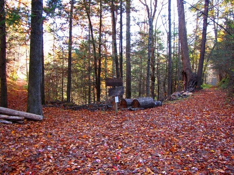
Rejuvinated and ready to return to the cove and finish the job, it was another early morning start at the Abrams Falls trailhead. This time I would make a loop of Rabbit Creek, Hannah Mountain, and Abrams Falls trails encompassing 11.2 miles. I would see another angle of the tornado destruction, enjoy some more fall color, and experience deja vu by hiking Abrams Falls for the second day in a row. All worth it, even the three unbridged stream crossings through ice cold waters. The first stream crossing happenings right out of the gate. I made the drive in my water shoes since it would have been pointless to change out of my boots just to put them back on one more time than necessary. The temperature was in the 30's still for the sun had recently risen, and I'm sure the water temperature was well below that. It sure felt like it anyways. Once you get both feet in that kind of water, the numbing, sluggish, and tingling sensations are quick to attack. Not the same refreshing feeling one would get in the summer time. I made it across quickly, dried off the feet and ankles, and slipped into my warm and dry boots. 
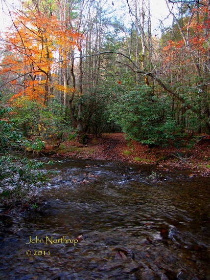
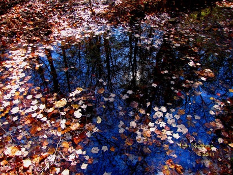
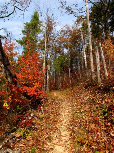
Much of the way along Rabbit Creek Trail saw me walking through a dense leaf litter of freshly fallen leaves. The crunching and swooshing sound caused by my steps was deafening at times but good fun. 
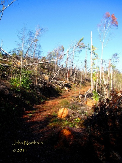
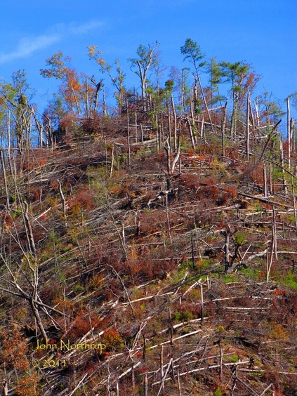
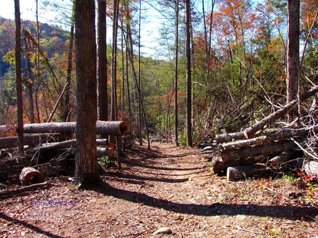
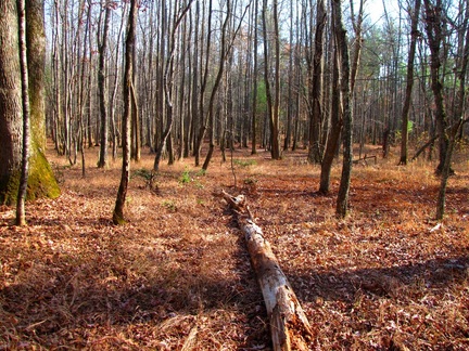
The second stream crossing at the campsite was hairy but I managed to make it across with my boots on, finding good foot holds on a few slick but sturdy rocks. Shortly after I passed through an area where heavy winds created several blowdowns, the major reason this 5.1 mile section of trail was closed until recently. It wasn't the path where the tornado passed through, but a great deal of damage had been done. Here at the junction with Hannah Mountain, you can see how it now serves as a sort of catch-all for debris. I didn't see it, but according to LeConte llama wrangler Alan, the shorter western portion of Rabbit Creek has a dramatic clearing from where the tornado tore through. I'll check that out at a later date. My journey was turning right on Hannah Mountain for the second half of the day's loop. 
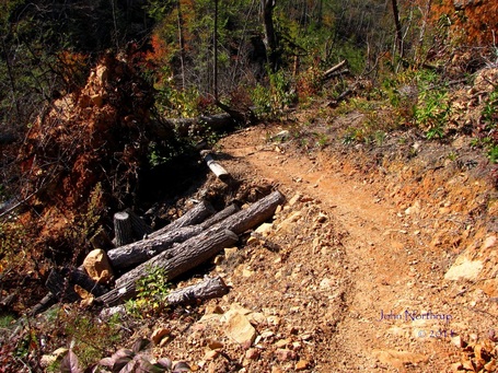
The last half mile before reaching Abrams Creek, the forest shows signs of destruction caused by fierce winds, perhaps stemming from the tornado's edges, but not in its direct path. The ridges were still in good shape, but the drainage that the trail follows was pretty gutted out. Uprooted trees and broken limbs were everywhere and the trail was lined with stacks of debris. Before the trail swings down toward the creek, I caught a glimpse of the devastation I had walked through yesterday, seeing the bare ridges up and to my left. The third and final stream crossing at Abrams Creek is not only the biggest for this loop, but one of the biggest in this park. I was fortunate in that we hadn't seen any rain recently, so water levels were on the low side. But I still needed to pick my path with precision, for there are several deep trenches that could send one swimming if careless. I tried to follow the under water plateaus, even if it meant heading up or down stream, not directly across the stream. Again, the water was biting with a crushing force of cold. Every few steps I would stand atop a boulder and wait just to let the slightly warmer air give me some relief. I imagine trying to do the trails with back-to-back-to-back stream crossings like Eagle Creek, Hazel Creek, and Forney Creek would be agonizing this time of year. I reached the other side, dried off, and threw on the boots with joy knowing that I wouldn't have to take them off again. 
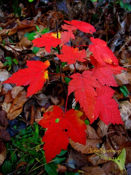
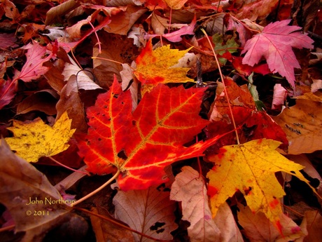
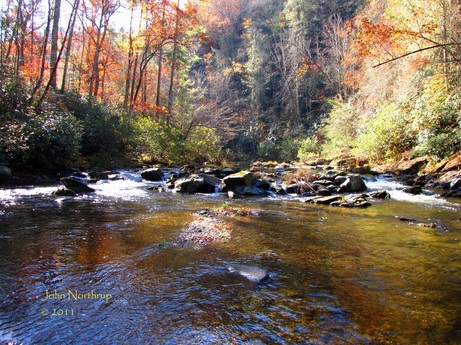
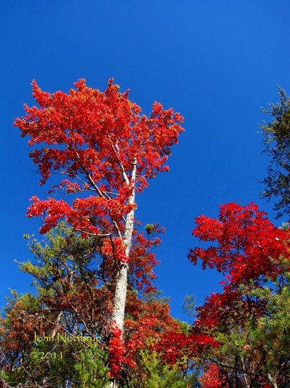
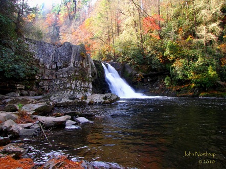
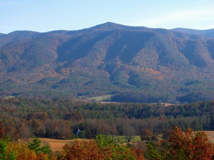
Here I was, back on Abrams Falls for the second time in about 18 hours. Not that I originally planned it this way, but if there's a 4.2 mile stretch I don't mind repeating just because it's so easy, this would be a good pick. The early morning light gave me a different look at the forest than I had yesterday afternoon. The fall colors were certainly standing out more, particularly the red maples like this little guy and the countless red oaks. Several of the ridges between the falls and the trailhead were just loaded with full and vibrant red oaks. I was grateful for not overextending myself yesterday to try and complete these trails and choosing to come back today and really enjoy myself and the wilderness.
2 Comments
After a three month hiatus from hiking any new miles in the park, it was time to get back on track. This was to be my best day in terms of weather, and with fall color peaking at the lowest elevations, the trails I had left west of the cove were screaming at me to be hiked. I gladly obliged and got an early start. I was nervous about reaching my destination because of the prescribed burns that park must do to preserve the cove and prevent the forest from moving in and eating it up. Alas, the trailhead at Abrams Falls was open when I arrived. I was also excited to be here because two more trails that were bombarded by the EF-4 Tornado back in April, Cooper Road and Rabbit Creek, had been reopened to public access. I was anxious to see what nature had done and how the park service had responded. It was shaping up to be a long but thoroughly rewarding day. What appears as a serene morning mist hovering over Cades Cove is actually the result of the park service's prescribed burns to maintain the current look of the fields. At least you can't smell it through the picture! Within a few miles, the evidence started to pile up in the form of broken trunks, uprooted stumps, and severed limbs. The path of the tornado has clearly left its mark on these mountains. Despite the destruction, the fall color was living up to and exceeding expectations. Here I look up at one of the most vibrant red maples and red oaks I have ever seen, and here they are side by side. Score! The out and back along Cane Creek was indeed monotonous, but occasionally broken up by unbridged stream crossings and pretty trees. At this crossing, leaves, water, sun, and sky meet in dramatic fashion. It took a while but I finally reached the terminus of Cooper Road at Abrams Creek Campground. Before beginning the final leg of the day's hike, I enjoyed a snack at this serene spot beside the water in silence. The Little Bottoms Trail is unique in that it is not a graded a trail much of the way. It skirts steeply up and down hills, meanders through boulders, tip-toes along the shore of Abrams Creek, and now possesses one of the most awesome and impressive sights in the park. In the last half mile heading southeast, one rounds a corner past a campsite and gets introduced to a rare sight. The trees - stripped, battered, and missing - now give way to a view that will surely take your breath away. You look up, out, and all around you and soak in the devastation. Your jaw drops, your eyes widen, and your steps get shorter. You yourself feel smaller in the grand scheme of things because the sight makes you realize that there are forces in this world that are infinitely greater and stronger than you'll ever be. It is one of the most humbling experiences I've ever had. Like the sands of the desert, the winds mold, crack, snap, and reshape the face of the Earth. Will the injuries sustained by this tree bring its end, or will it survive and prevail? Only time will tell here. The landscape has been altered forever, and the next several decades will see a great amount of change in this corner of the park. The response by the trail maintenance crews of this park and the others that came to its aid was incredible. Their work in removing the debris and reconstructing trails amid the devastation has been masterful and should be commended. The trails they've been able to reopen are those that criss-crossed the path of the tornado. Those that the twister basically followed for miles and miles, Hatcher Mountain and Beard Cane, remain closed and will take a great deal of time and effort to clear and reconstruct. But from what I've seen, the crews are up to the task and the end product should be first class. Job well done! I call this Tulip Poplar now the "Tree of Hope." It stands tall and proud, yet severely battered, approximately 70-80 feet in the air. It has been completely stripped of all its limbs from bottom to top, like a utility pole, save for this little bush at the very top. Somehow, this tree was able to weather the storm and cling to life. It serves as a reminder that there is always hope, that all things are possible, whatever the conditions, despite the great adversities one may face. My original plan to finish out the remaining trails west of the cove fell short once I reached the junction with Abrams Falls Trail. Instead of taking Hannah Mountain and Rabbit Creek back to my vehicle, I decided to save the toll on my legs and shave off a few miles and elevation change. I also wanted to be able to enjoy those trails instead of dreading them by dragging my feet as dark approaches. I took Abrams Falls because it was the quickest and most direct way back. When I reached the falls, the lighting was optimal for good pictures, so I stopped for a bit and enjoyed it. Those last few miles of the hike saw me in a state of shock and humility from the scene I had just witnessed. If you ever have a chance to hike the trails west of Cades Cove, especially when all the trails have been reopened, I would highly recommend doing so. It is an unforgettable sight to see.
Entry regarding loop hike with Bonnie west of Cades Cove coming soon! A serene morning beside Abrams Falls. Some lingering fall color along a dry Hatcher Mountain Trail. View across Cades Cove from trailhead of Cooper Road. Crossing a fortunately dry flood plain via Wet Bottom Trail. A popular Cades Cove overlook as seen from Rich Mountain Road.
|
Thanks for visiting!I appreciate you stopping by. This site is for your enjoyment as much as it is mine. Look for new photos and journal entries about every 1-2 weeks. Archives
November 2011
Categories
All
|